How Does GPR Work?
How Do You See What’s Beneath the Surface Without Digging?
Ground Penetrating Radar (GPR) is a non-destructive technology that uses high-frequency radio waves to create a visual “map” of the subsurface. This method allows professionals to identify objects, voids, utilities, and other underground features quickly, safely, and without excavation.
How GPR Works
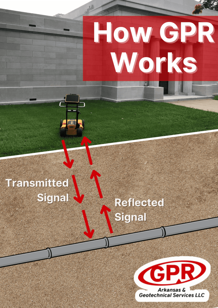
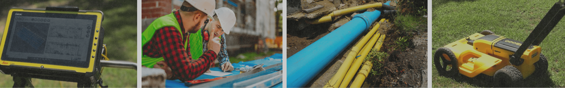
During a GPR scan, a technician pushes or pulls a specialized cart across the area in a systematic grid pattern. This ensures complete coverage and accurate data.
Here’s what happens during scanning:
- Energy Transmission: A GPR transmitter sends short pulses of electromagnetic energy into the ground.
- Wave Interaction: As these waves travel downward, they encounter various materials—soil, rock, metal, concrete, voids, or groundwater.
- Reflections: When a wave hits something with a different electrical property (called dielectric contrast), part of the signal bounces back to the surface.
- Signal Collection: A receiving antenna on the GPR unit records these reflections in real time.
- Subsurface Imaging: Software converts the data into cross-sectional images (radargrams) and depth estimates, revealing anomalies, materials, and buried objects.
This process gives technicians a clear view of what lies beneath without disturbing the ground.
What Can Ground Penetrating Radar Detect?
GPR is highly versatile and effective in a variety of conditions, especially in dry or non-clayey soils. It can detect:
Utility Lines & Pipes
Subsurface Anomalies
- Voids and sinkholes
- Buried foundations or concrete features
- Underground storage tanks
- Rebar patterns and reinforcement layouts
- Roots, rocks, and debris fields
- Soil disturbances related to past construction
Depth & Position of Features
GPR not only locates subsurface objects but also provides accurate depth estimates, helping project managers plan safely and efficiently.
Common Applications of GPR
GPR is used across a wide range of industries, including:
- Construction: Pre-excavation scanning, utility mapping, cutting and coring safety
- Environmental: Locating USTs, monitoring soil contamination, identifying buried debris
- Geotechnical Engineering: Identifying voids, soil layering, and assessing subsurface stability
- Archaeology & Historical Preservation: Mapping buried structures or artifacts
- Concrete Inspection: Finding rebar, conduits, and verifying slab thickness
- Public Works: Water leak investigations, roadway assessments
Why GPR Matters
Using GPR helps teams:
- Avoid costly utility strikes
- Reduce downtime and keep projects on schedule
- Improve safety for crews and equipment
- Make informed decisions based on accurate subsurface data
- Minimize unnecessary excavation
Learn more about Ground Penetrating Radar
For a deeper dive into the science behind GPR, visit reputable resources such as Science Direct.
If you have a project in Arkansas or the surrounding region, GPR Arkansas & Geotechnical Services LLC is ready to help. Our team provides precise, professional subsurface scanning to keep your project safe, efficient, and compliant.
Have questions or need a quote? Contact GPR Arkansas today.