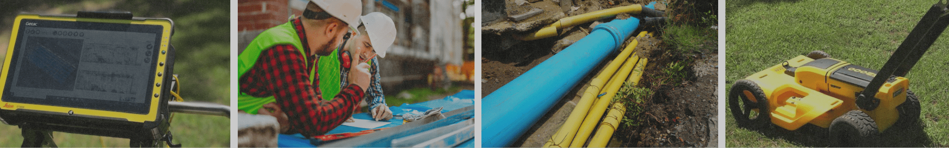

 Ground penetrating radar is a technology used in various fields, including construction, engineering, archaeology, and geology. It involves the use of radar pulses to image the subsurface of the ground or other materials. GPR is often used to locate buried objects, map geological features, assess pavement conditions, and identify underground utilities.
 GPR works by transmitting short pulses of electromagnetic energy into the ground and recording the reflections that bounce back from subsurface interfaces, allowing the creation of images or maps of subsurface features.
To learn more, read our blog "How Does Ground Penetrating Radar Work?"
 GPR can be used in various applications, including engineering, environmental studies, and utility mapping. It can help locate buried objects like pipes, cables, and rebar, assess the thickness and condition of pavement layers, detect voids, fractures, or sinkholes in the ground, and identify geological structures or groundwater levels. Learn more about commercial and residential GPR.
Learn more in our blog "What Object Can GPR Detect?"
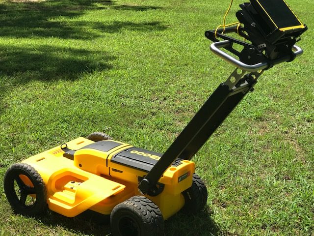
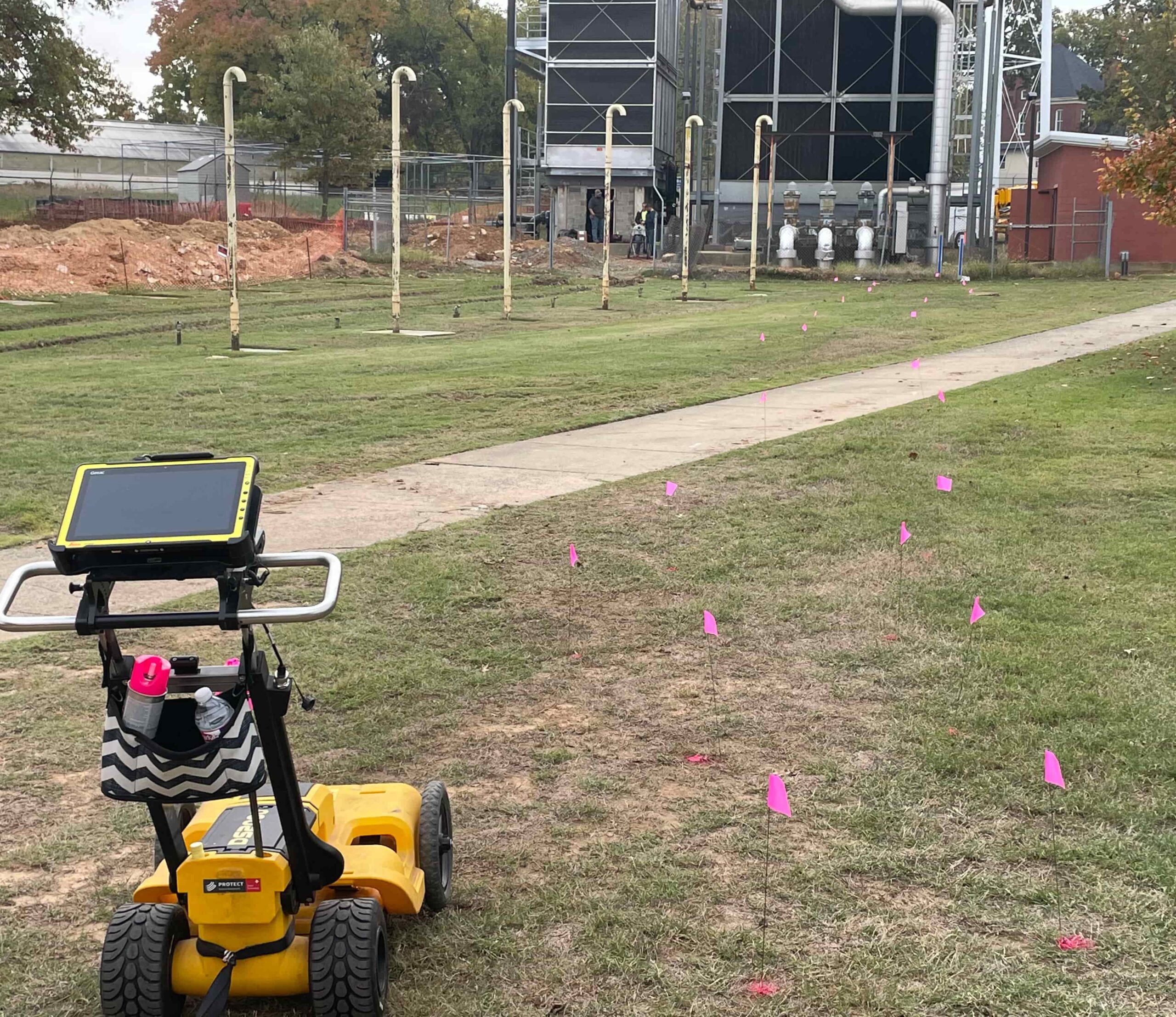
 A typical GPR system consists of a transmitting antenna, a receiving antenna, a control unit, and a display unit for data visualization. At GPR Arkansas, we frequently use a system that resembles a push lawn mower.
Yes. Ground-penetrating radar goes by several names including, georadar (or geo radar), GPR, ground probing, impulse radar, and ultra-wideband radar.
The penetration depth of GPR depends on the frequency of the radar signal used. Higher frequencies provide better resolution but lower penetration, while lower frequencies have greater penetration but lower resolution.
Yes, soil types and conditions are important. The electrical properties of the soil, particularly the dielectric permittivity and electrical conductivity, affect how the radar waves propagate through the ground and interact with subsurface features. Therefore, understanding the soil type is crucial for interpreting GPR data accurately.
Discover more about how soil properties affect GPR in our blog "How Do Soil Properties Affect Ground Penetrating Radar (GPR) Results"
GPR is considered safe for humans and the environment since it uses non-ionizing radiation, similar to radio waves or microwaves.
Yes, GPR is commonly used for utility mapping to detect and locate buried pipes, cables, and other subsurface infrastructure. (Read GPR Finds Underground Conduit)
 Yes, GPR can penetrate concrete to some extent, depending on its thickness, composition, and reinforcing materials. Higher frequency GPR antennas are typically used to investigate shallow depths in concrete. (Read GPR Arkansas Offers Concrete Slab Scanning)
GPR can generally detect non-metallic objects, including PVC pipes. However, the effectiveness of detection may vary depending on the pipe's depth, size, and the soil or material surrounding it.
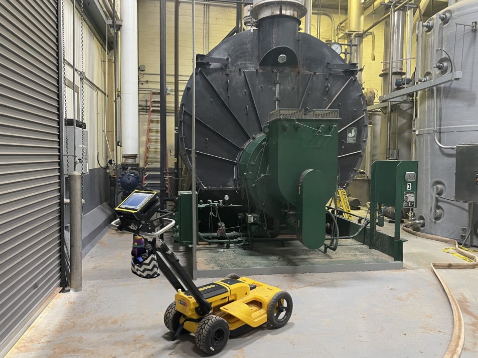 Yes, GPR can be used indoors. It is a versatile technique that can be applied to both outdoor and indoor environments, such as buildings, structures, and underground facilities. GPR can be used to scan concrete floors as well as walls. (Read Boiler Room Water Leak Found With GPR)
 A GPR readout typically displays a cross-sectional image or a time-domain waveform that represents the subsurface reflections captured by the GPR system.
The GPR readout can be displayed as a 2D profile, often referred to as a radargram, showing the depth of features along the horizontal axis and the strength of reflections or amplitude along the vertical axis.
The GPR readout provides information about subsurface features such as changes in soil or sediment layers, buried objects, geological structures, and voids. It can also help determine the depth, size, and spatial arrangement of these features.
The GPR readout can provide indications of variations in subsurface materials based on the amplitude, shape, and frequency content of the reflections. However, distinguishing between specific materials usually requires additional information or data analysis techniques.
 Yes, in some cases, GPR systems can provide real-time data processing and visualization, allowing for immediate mapping of subsurface features as the data is being collected.

GPR is used for detecting and mapping burials in archaeological investigations and forensic applications. It can identify disturbances in the subsurface that may indicate burial sites, such as variations in soil composition or grave shafts. At GPR Arkansas, we have worked with cemeteries to help ensure no unmarked graves or other objects, such as buried utility lines, were present in a space marked for expansion. (Read GPR Cemetery Mapping Before Digging)

Yes, GPR can be used to create 3D models of the subsurface. By collecting data from multiple overlapping profiles, GPR data can be processed and integrated to generate three-dimensional representations of the subsurface features.
To create a 3D model, GPR data is collected along parallel or intersecting lines, capturing information from different perspectives. By combining these data sets and applying imaging algorithms, a volumetric representation of the subsurface can be reconstructed.
Creating 3D models with GPR allows for a more comprehensive understanding of the subsurface. It provides a visual representation of the spatial distribution and relationships between subsurface features, enabling enhanced interpretation, analysis, and planning.
Operating GPR systems and interpreting the data typically requires specialized training and experience to ensure accurate results and proper data analysis. At GPR Arkansas, we have the expert training and knowledge to properly meet your surveying needs.

Yes, we offer free estimates at GPR Arkansas. Contact us to request your free estimate.
Sinkholes and voids both create empty spaces that can threaten structures and safety, but they form in different ways. Sinkholes are usually caused by the collapse of underground rock or soil, while voids often result from construction issues or settling over time. Both can be detected with Ground Penetrating Radar (GPR).
Learn more about sinkholes vs. voids in our blog "Sinkholes Vs. Voids: What is the Difference?"
Drones equipped with Ground Penetrating Radar (GPR) allow technicians to survey hazardous or hard-to-reach areas—like mountains, highways, or flooded sites—without being on the ground. This reduces risks, expands access, and provides high-definition images and accurate underground data.
Read more about the benefits of drone surveying in our blog "How Drones Can Enhance GPR"
Not always. 811 marks public utility lines but does not detect private utilities, abandoned lines, voids, or underground storage tanks. Ground Penetrating Radar (GPR) fills these gaps by providing a complete picture of subsurface conditions.
Read more about the limitations of 811 and how GPR helps in our blog "Understanding the Limitations of 811/One Call Services"
Skipping an underground scan can lead to serious safety hazards, costly repairs, and major project delays. Striking gas lines, water pipes, or hidden voids can cause accidents and expensive damage. While calling 811 is important, Ground Penetrating Radar (GPR) provides a more complete picture to keep your project safe and on track.
Read more about the risks of not looking underground in our blog "What Happens if You Do Not Look Underground Before Starting a Project?"
Several elements influence the pricing of a ground-penetrating radar survey, including:
Project size and area coverage
Depth of penetration required
Number of anomalies or targets to locate
Accessibility and site conditions
Report generation and mapping requirements
We provide customized quotes after evaluating your project to ensure transparency and value.
The duration of a GPR survey depends on the size of the area, the depth of the scan, and the complexity of the site. For example, a standard residential slab or small commercial site typically takes 1–3 hours, while larger commercial or industrial projects may take a full day or more. Planning ahead ensures we can provide accurate results efficiently.
Yes! Preparing the site helps ensure accurate ground-penetrating radar results. For best results:
Remove furniture, debris, or loose soil
Mark known utilities or underground features if possible
Ensure clear access to all areas that need scanning
Our team will provide guidance on site prep during scheduling to make the process smooth and efficient.
The optimal timing for a ground-penetrating radar survey depends on your project:
Pre-construction: Ideal for identifying hidden utilities or subsurface anomalies before excavation
Pre-renovation: Helps locate structural elements, voids, or utilities
Seasonal considerations: Dry soil conditions generally yield the most accurate results, but our team can adapt to all conditions
Scheduling at the right time ensures maximum efficiency and actionable data.
Scanning for rebar is one of the most important steps before drilling, coring, or sawing into concrete. Rebar is typically hidden inside the slab and isn’t always shown on blueprints or utility maps. If you begin cutting without locating it first, you can run into problems such as:
Damaged tools and equipment
Safety hazards from flying debris or sudden tool malfunction
Compromising the structural integrity of the concrete
Unexpected project delays and added costs
That’s why GPR (Ground Penetrating Radar) is the preferred method for locating rebar, post-tension cable, and utilities before you start cutting. It provides fast, accurate results without damaging the concrete surface.
To learn more about how the process works and why it matters, check out our blog on scanning for rebar with GPR. It explains what rebar is, how it’s detected, and why scanning protects your project, your crew, and your equipment.
Ground penetrating radar (GPR) and electromagnetic (EM) locating are both used to identify underground utilities, but they work in very different ways.
Electromagnetic locating detects utilities by tracing electrical signals through conductive materials, making it effective for locating metal pipes, electrical lines, and steel conduits. However, it cannot detect non-metallic utilities like PVC or plastic pipes unless a tracer wire is present.
GPR, on the other hand, uses radar technology to scan below the surface and detect changes in material density. This allows it to locate both metallic and non-metallic utilities, including PVC, fiber optic lines, and other buried infrastructure—while also providing depth information.
Because of this, GPR is often considered the more comprehensive solution, especially on modern job sites where non-metallic materials are common or utility records may be incomplete.
👉 Learn more about how these methods compare in our blog: GPR vs Electromagnetic Utility Locating